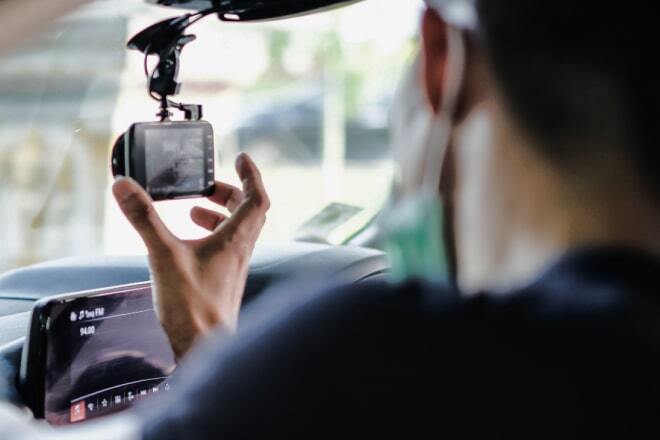
PoC Device for Wide-Range Video Recording
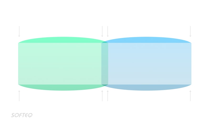
Merging two camera feeds in real time
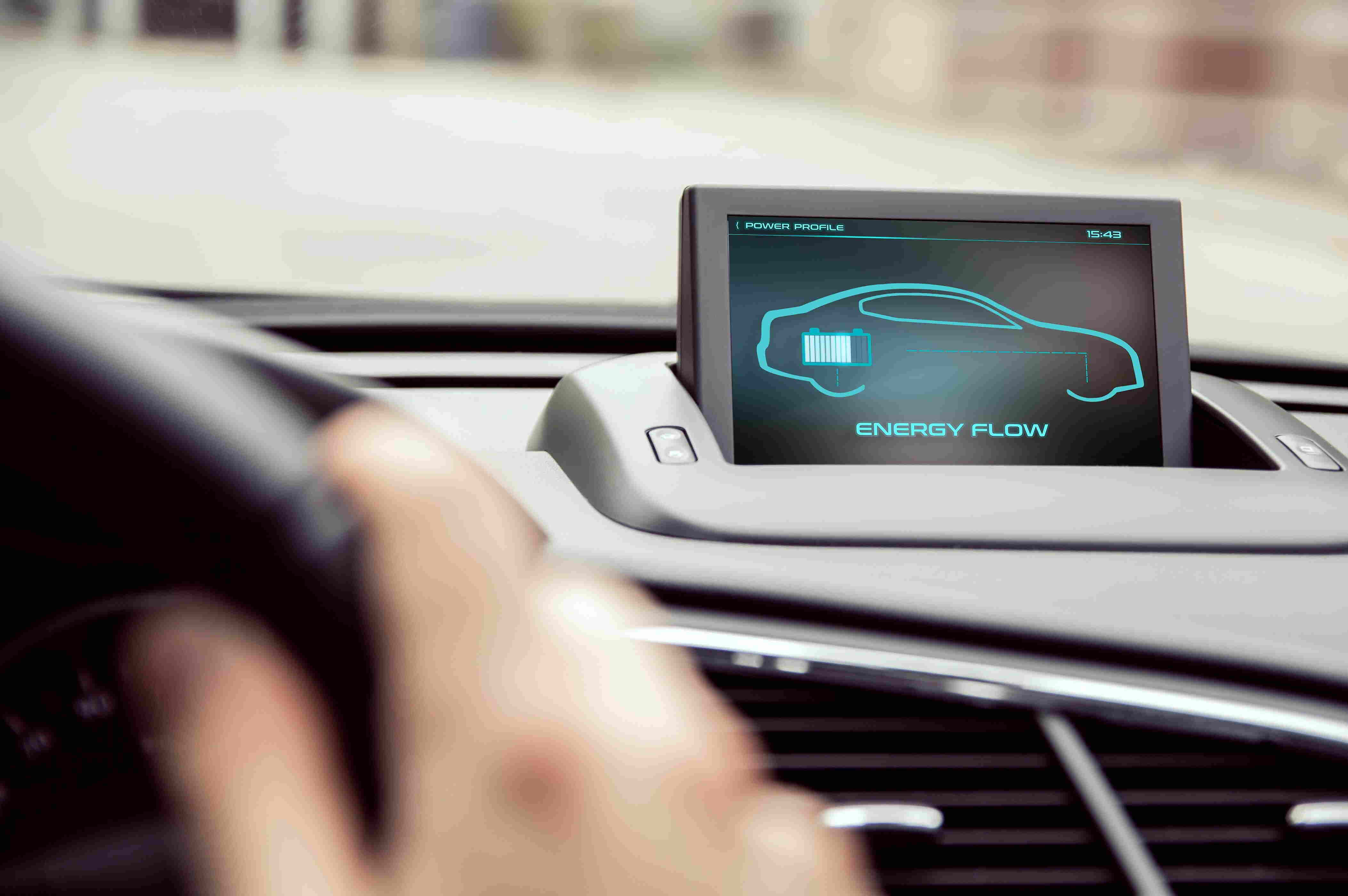
The client is an insurance technology company that develops telematics solutions. This project was a dashcam-like device for installation on a vehicle windshield.
Solution
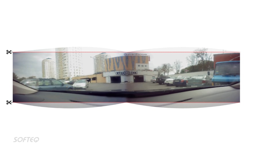
Real-Time Video Stitching
Softeq developed a PoC solution that combines two video feeds to create a single panoramic video. Due to the apparent difference in the object position caused by different camera angles, simply merging the feeds without additional processing was not enough to create a seamless video. For this reason, we developed a Linux board support package that enables the solution to apply the necessary video corrections in real time. The solution is based on the NXP processor and supports Wi-Fi and LTE connectivity for sending data to the AWS cloud.
How it Works
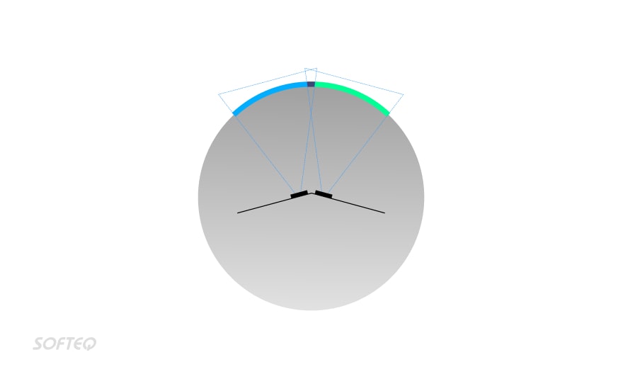
1. Applies synchronous exposure and white balance corrections to video footage obtained from both cameras
2. Projects the videos on a 3D sphere
3. Merges the feeds using a smooth stitching algorithm
4. Maps the merged video on to a two-dimensional plane
5. Removes the fish-eye effect using the squeezing and stretching algorithms
Looking to Amplify Your Media Content Strategy?
See how our custom media solutions streamline content distribution, unlock user behavior insights, and enable real-time personalized content delivery Learn more